|
The Fort
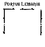
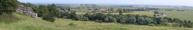
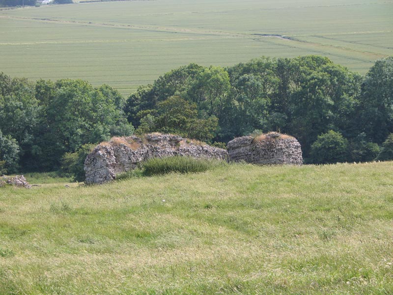
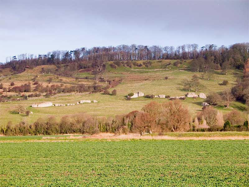
I visited the remains of the fort at Portus
Lemanis (a.k.a. Stutfall Castle) in the high summer of 2004; it was hot and sticky as I
struggled through a disused path of brambles and nettles on a slippery hillside (image 1)
beneath the mediaeval castle to get close for a couple of images. It
seems a neglected monument on a lovely spot and my researches have uncovered surprisingly
little about the fort apart from two interesting prints.
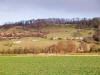
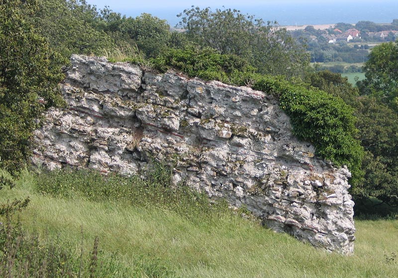
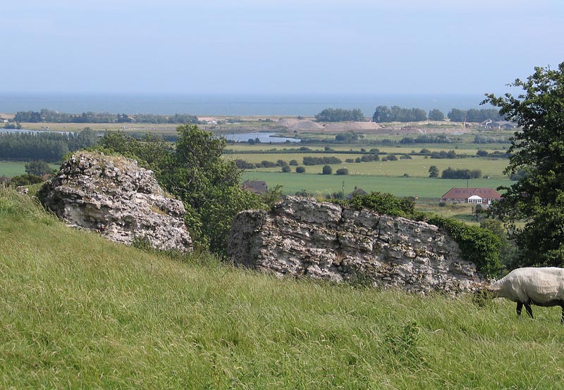
At the site you can see
from my pictures that there is not much to see apart from the surviving
bits of walls (2,3&4) at strange
angles and moved by gravity from their original positions (on private land, BTW). This
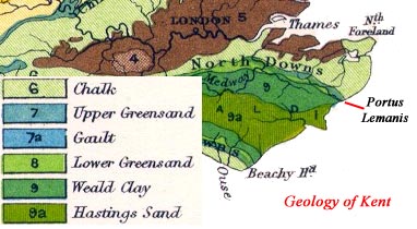
hill slippage is due to the geology of the area: Upper Greensand, Gault
clay, Lower Greensand and Wealden clay. These all slide over one another aided
by several streams outing from the escarpment making landslides a
frequent occurrence since Roman times. The unstable nature of the
escarpment may have been the reason the fort and port was disused as a naval
base. Ragstone from the lower Greensand may have provided the rock for
the buildings and forts in this part of Kent.
Geology map.
 The
fort was one of the Saxon Shore forts like
Richborough built for
protection from raiders in the late 3rd century. The walls, 3 or 4m. thick at
their base, would have stood over 6m. high and stood on oak piles sunk
into the clay; they also have the usual tile bonding courses and
bastions on the corners The
fort was one of the Saxon Shore forts like
Richborough built for
protection from raiders in the late 3rd century. The walls, 3 or 4m. thick at
their base, would have stood over 6m. high and stood on oak piles sunk
into the clay; they also have the usual tile bonding courses and
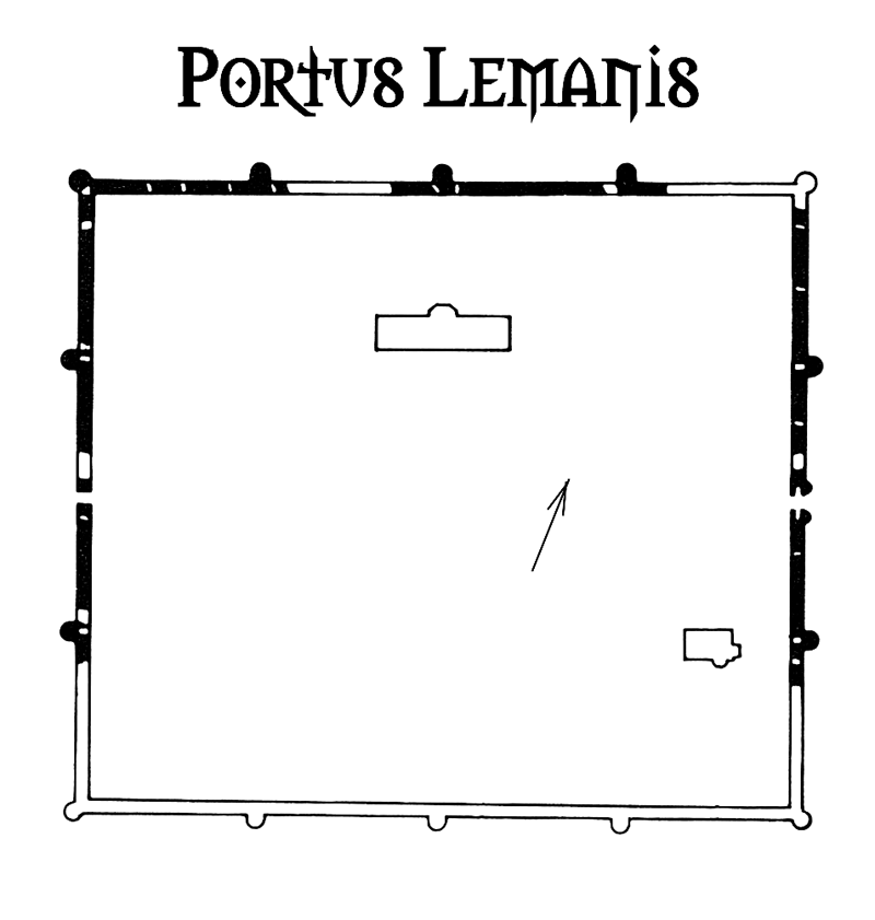
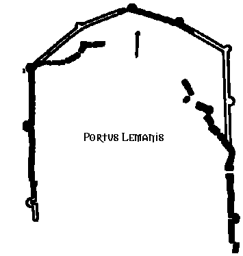
bastions on the corners. Detsicas' plan (above right) has the fort being
square but it seems to be, in fact, the shape of an irregular pentagon
enclosing an area of up to 10 acres. The Saxon Shore fort developed from
an earlier base.
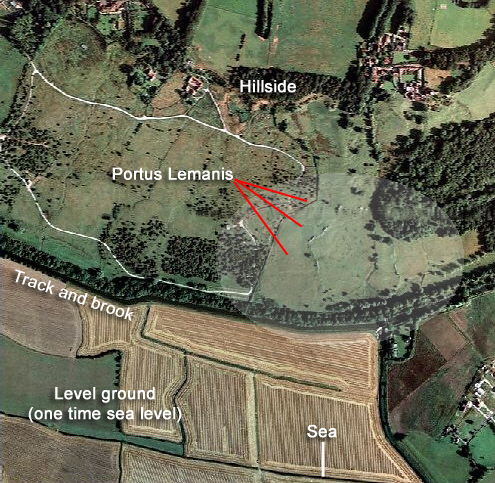
The Port
 The port, I guess, must have been in the area running from the
West Hythe car park to the base of the hill below the fort (see aerial
image 1) east a few hundred
metres where the sea would have reached in those times. The coastline
looked very different in those days with Portus Lemanis at the entrance
to an inland lagoon and wetland behind a shingle beach that had built up
from Fairlight (Hastings) almost to the port. The port served the Weald industrial area - iron
mining and smelting - close by to the west with the rivers Rother and
Brede providing access right into the heart of the Weald. Whatever went on at
Portus Lemanis, the export of iron and timber from the Weald and
even salt from panning on the Romney Marsh, it was mentioned as a port in the ancient libraries
and itineraries; a vicus is bound to have built up around the
port to serve it and the garrison. Roman settlements are also believed
to have been at Ruckinge (inland) and Dymnchurch (opposite). The connection with Canterbury is
impressive: a beautifully straight Roman road called Stone Street still
runs from north of nearby Hythe into the city to this day. The port, I guess, must have been in the area running from the
West Hythe car park to the base of the hill below the fort (see aerial
image 1) east a few hundred
metres where the sea would have reached in those times. The coastline
looked very different in those days with Portus Lemanis at the entrance
to an inland lagoon and wetland behind a shingle beach that had built up
from Fairlight (Hastings) almost to the port. The port served the Weald industrial area - iron
mining and smelting - close by to the west with the rivers Rother and
Brede providing access right into the heart of the Weald. Whatever went on at
Portus Lemanis, the export of iron and timber from the Weald and
even salt from panning on the Romney Marsh, it was mentioned as a port in the ancient libraries
and itineraries; a vicus is bound to have built up around the
port to serve it and the garrison. Roman settlements are also believed
to have been at Ruckinge (inland) and Dymnchurch (opposite). The connection with Canterbury is
impressive: a beautifully straight Roman road called Stone Street still
runs from north of nearby Hythe into the city to this day.
The Military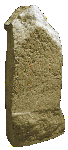
There seems some debate about the Classis
Britannica (British Fleet) and whether its main harbour was at Dover
or Lympne. Tiles stamped with CL.BR have been found on the site
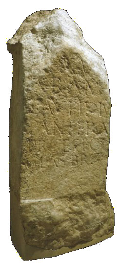
indicating the navy's presence. There is some more evidence, however: a limestone altar stone
found during an excavation by Charles Smith in 1850 is dedicated to
Neptune, Roman God of the Sea, by a high ranking officer, a praefectus (commander) of
the British fleet in AD 133 who had commanded a large cavalry regiment
in Pannonia Superior (modern Hungary). The inscription reads:
| NEPTVNO ARAM L AVFIDIVS
PANTERA PRAEFECT CLAS BRIT |
| "For
Neptune, an altar [dedicated by] Lucius Aufidius Pantera,
prefect of the British Fleet." |
The
Notitia Dignitatum,
one of the early sources I mentioned, reports another military unit at the site Praepositus numeri
Turnacensium, Lemannis meaning: "The Leader of the Company of
Turnacenses at [Portus] Lemannis."
Old Prints
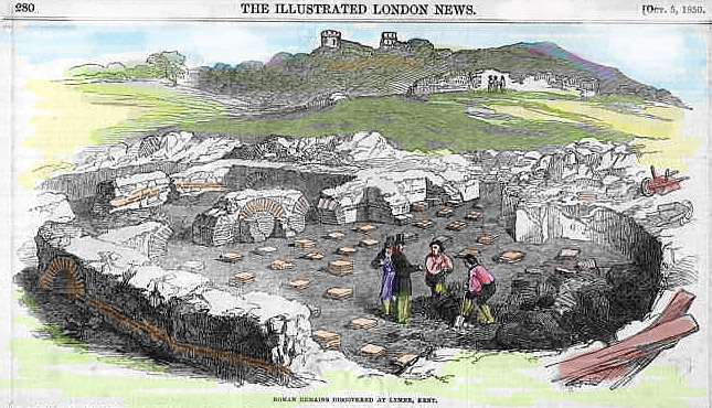
 Charles
Roach Smith's excavation which found the once barnacle encrusted altar
stone above was reported in an issue of the "Illustrated London News" of 1850 along with an excellent contemporary
etching/woodcut (right). Originally a black
and white image, I coloured the line print to highlight the hypercaust
tiles which reveal this must have been the soldiers' or officers' bath house.
The print shows more than is visible today
including the wall in the far distance which is no longer standing. Charles
Roach Smith's excavation which found the once barnacle encrusted altar
stone above was reported in an issue of the "Illustrated London News" of 1850 along with an excellent contemporary
etching/woodcut (right). Originally a black
and white image, I coloured the line print to highlight the hypercaust
tiles which reveal this must have been the soldiers' or officers' bath house.
The print shows more than is visible today
including the wall in the far distance which is no longer standing.
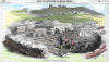
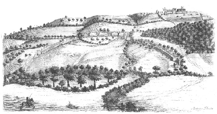
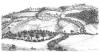 Another
etching or woodcut from even earlier time, taken from a book called
Itinerarium
Curiosum by William Stukeley, ca.1716,
reveals the walls complete with lacing tiles and the west gate. Of course, much of
this masonry will have 'robbed out' and ended up in later buildings. This print shows
that the
fort, with most of its wall standing, was not square in shape as Detsicas draws in his book
but appears more nearly semi-circular. The pentagon
theme is echoed in a sacellum found on the site which is also
pentagonal. Another
etching or woodcut from even earlier time, taken from a book called
Itinerarium
Curiosum by William Stukeley, ca.1716,
reveals the walls complete with lacing tiles and the west gate. Of course, much of
this masonry will have 'robbed out' and ended up in later buildings. This print shows
that the
fort, with most of its wall standing, was not square in shape as Detsicas draws in his book
but appears more nearly semi-circular. The pentagon
theme is echoed in a sacellum found on the site which is also
pentagonal.
|